
Walk a Derby Street by Address
A Derby street directory search works best as a chain of dated records. The county map can establish where a parcel sits and how the county identifies it. A deed can connect named parties to that legal description on its recording date. Neither source proves who is inside the building now. Historical directories can add an occupant for a past year, while voter information has access and use limits and should never be treated as a public block roster.
- Confirm the exact spelling, suffix, directional, and cross street on the official Derby street map.
- Search the address in My Local Taxes, select the parcel, and save its PIN and legal description.
- Open Mobile Land Records to view adjoining parcels. Treat its tax lines as map guidance, not a boundary survey.
- Use the Sedgwick County Register of Deeds index to connect the parcel description with recorded parties and instruments.
- For an earlier household, compare a dated criss-cross directory with deeds, census material, newspapers, and maps.
This sequence prevents a common error: turning an owner name into a claim about current residence. A mailing address may point elsewhere, and a deed party may never have occupied the property. Note the source date at every step.
Normalize Derby Street Names First
The official Derby street map is the fastest place to settle spelling and current location. Record the suffix, any directional, the address range, the nearest cross street, and the subdivision name. The map includes El Paso Drive, a useful warning that modern and historical labels may overlap with Derby's former city name.
No public line-by-line renumbering or alias log was found. For an address that disappears between sources, ask City GIS or the City Clerk for the permanent Street Name File, related plat, subdivision and survey files, vacation petitions, and any addressing resolution for the street and date range. Derby's retention schedule identifies those files as permanent.
Note: A missing old address may reflect a changed label or plat, not an absent household.
Search Derby Parcel Map Fields
My Local Taxes accepts an address or place and opens parcel-level details. The broader county record may include the PIN, legal description, owner, mailing address, lot size, values, parcel traits, special assessments, and billing detail. For a Derby street directory result, preserve the physical address and mailing address as separate fields.
| Map field | How to search | What to save | Limit |
|---|---|---|---|
| Address or place | Enter the current street form | Situs address | May miss an old name |
| PIN | Select or enter the parcel ID | Stable county key | Not a person identifier |
| Street intersection | Use Mobile Land Records | Map context and nearby parcels | No verified radius tool |
| Legal description | Open parcel details | Lot, block, subdivision, or land call | Can change after a replat |
The Mobile Land Records map supports address, PIN, and street-intersection searches. County GIS says parcel boundaries are for tax use, are not a survey, and are generally within about three feet countywide.
Open the county mobile parcel viewer before using the interface shown below.

The map view helps anchor a street result to a parcel, but a deed or survey is needed for stronger legal evidence.
Derby Street Records and Keepers
No single Derby database combines ownership, taxes, deeds, postal labels, street changes, and historical occupancy. Each custodian answers a narrower question. Use this coverage table to choose the next source instead of assuming one search result is a full street directory.
| Record Set | Keeper | What It Shows | Access |
|---|---|---|---|
| Parcel and tax record | Sedgwick County Appraiser and Treasurer | Situs, owner, mailing address, PIN, value | Online map or county request |
| GIS parcel map | Sedgwick County GIS | Parcel position, lines, measurements, intersections | Free viewers or GIS appointment |
| Deeds and land instruments | Register of Deeds | Recorded parties, dates, legal description, document number | Online services, public computers, or index books |
| Street and plat files | Derby GIS, Engineering, and City Clerk | Name changes, plats, surveys, vacations, subdivision context | Maps or a targeted KORA request |
| Historical address directories | Derby and Wichita libraries, MHGS | Dated address-to-name or name-to-address evidence | Digital, microfilm, or in person |
The PIN and legal description tie the county map to recorded instruments. The street name joins maps to directories, but it is less stable over time. VoterView is a person-specific lookup requiring a first name, last name, and date of birth. Kansas law also governs supervised inspection and copies, so it is not an open street-by-street name tool.
Connect Derby Parcels to Deeds
The Sedgwick land-record search indexes deeds from 1945 forward and other records from 1969 forward, though some documents are not online. Search instructions allow a document number or film and page, date range, party name, grantor or grantee role, subdivision with lot and block, and section-township-range. A blue document number can open a PDF, while View Details shows index data.
A street number is only a lead. Compare the legal description on the parcel with the indexed description and the recorded image. If the two diverge, check a plat or earlier deed. The Register of Deeds offers free public computers weekdays from 8 a.m. to 5 p.m.; Tapestry is pay-per-search, Laredo is subscription access, and older searches may require office index books.
- Parcel
- A mapped unit the county uses for tax and appraisal records.
- Situs address
- The physical location of the parcel, distinct from the owner's mailing address.
- Plat
- A recorded map that divides land into lots, blocks, streets, or other areas.
- Criss-cross directory
- A volume arranged by address or phone number, useful for finding a dated household name.
Derby Maps Explain Street Context
The Derby Maps and GIS office maintains data for wards, sewer connections, infrastructure, planning, stormwater, and several city map products. Those layers can explain why a street segment belongs to a certain subdivision or service area. They do not create a public household list.
Review the City of Derby map catalog alongside the captured interface below.
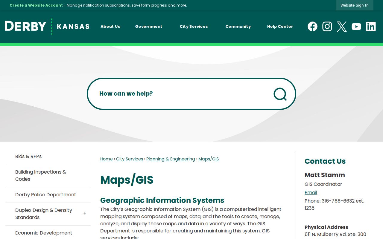
The city map route is best for street form and civic geography; county parcel and deed sources carry the ownership trail.
Derby Streets Carry El Paso
Derby's earlier name matters in a backward street search. The settlement was platted as El Paso in 1871, the railroad depot adopted Derby in 1880 after mail confusion with El Paso, Texas, and the city formally changed its name in 1956. The 1877 Wichita directory includes El Paso in a distance table, while today's street map still includes El Paso Drive.
For an old deed, directory entry, newspaper item, or map, try Derby, El Paso, the relevant township, and the postal label used in that year. Treat each as a search term, not proof that every record refers to the same parcel. This local story is also why the legal description and source year carry more weight than a modern street label.
Derby ZIP Is Not City Proof
The official county ZIP map places 67037 at Derby, but a ZIP is a mail route rather than a legal city boundary. The postal city, municipal line, county parcel geography, and a historical directory label can differ without any one source being wrong. Use the USPS ZIP lookup for the exact mailing form, then compare the city and county GIS layers.
Save the full USPS result, the parcel municipality, the ZIP shown by the dated directory, and any annexation or plat context. This makes a Derby street directory entry reproducible, especially near an edge address.
Note: Do not filter all Derby records by one ZIP without stating the postal-boundary assumption.
Document a Derby Street Result
A reproducible street directory entry needs more than a copied owner name. Save the observation date, map URL, exact address form, PIN, legal description, and the document number for any deed used. Identify whether each name came from a parcel card, recorded instrument, voter source, or dated directory. Add the directory volume and page when the claim concerns an earlier household.
Keep uncertainty visible. If adjoining parcels are judged from shared map edges, state that the GIS lines are not a survey. If a street changed name, cite the city file or dated map that supports the match. When a historical place label is ambiguous, preserve both terms and do not merge the people attached to them. This evidence record makes later checks possible when a portal, tax roll, or map layer changes.
Limits of a Derby Street Directory
A parcel owner is not necessarily the person who lives at the situs address. Mailing information may point to another place, a recorded party may relate only to an old instrument, and a directory line reflects only its publication year. GIS cannot prove occupancy. VoterView does not support browsing all names on a street, and protected or substitute addresses must remain protected.
The sound use of a street directory is narrow and dated: property curiosity, deed research, family history, civic transparency, or checking a seller's claim against an official record. Confirm a match across two sources, preserve the legal-description key, and state what the evidence cannot establish.
Lawful use. Use Derby address records only for lawful personal research. Never use a street result to stalk, harass, intimidate, or indirectly identify someone with a protected address.